By Aaron Wilson
Summary
Did it feel like winter was largely absent during January? If so, you are not alone, and we have the climate statistics to prove it. Figure 1 shows that much of the state will end the month with temperatures about 10°F above the long-term average (1991-2020). This places January 2023 in the top 5 warmest Januarys on record for many cities across the state. It was also a wet month, with precipitation running 125-200% of normal. Frequent systems, typical of the La Niña weather pattern we are in, helped recharge soil moisture and elevate stream flows across the state. With the lack of cold weather and wet conditions, muddy conditions are now being felt by many across Ohio.
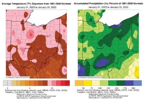
Figure 1: (left) Departure from 1991-2020 normal temperatures and (right) percent of normal precipitation for January 2023. Figure courtesy of the Midwestern Regional Climate Center.
Forecast
This week will feature a much colder and overall drier pattern for Ohio. Chilly conditions will be in place for Tuesday and Wednesday with highs generally in the 20s and overnight lows in the teens. After a brief warm up into the 30s on Thursday, cold air will punch south again for Friday with highs only in the teens and 20s and overnight lows in the single digits and teens across the state. Another warm up is expected heading into the upcoming weekend. After a bit of wintry mix across southern counties on Tuesday, the next chance of rain and/or snow will arrive on Sunday. Overall, the Weather Prediction Center is currently forecasting less than 0.10” statewide over the next 7 days.
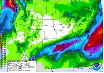
Figure 2). Precipitation forecast from the Weather Prediction Center for 7pm Monday January 30 – 7pm Monday February 6, 2022.
Heading into the second week in February, guidance from the Climate Prediction Center and the 16-Day Rainfall Outlook from NOAA/NWS/Ohio River Forecast Center show temperatures and precipitation are likely to remain above average. Climate averages include a high-temperature range of 35-40°F, a low-temperature range of 18-23°F, and average weekly total precipitation of ~0.65 inches. February’s outlook is similar, with above normal temperatures and precipitation likely to stick around throughout the month with short periods of colder air.
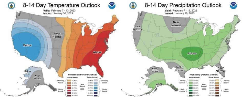
Climate Prediction Center 8-14 Day Outlook valid for February 7 - 13, 2023, for left) temperatures and right) precipitation. Colors represent the probability of below, normal, or above normal conditions.
Source : osu.edu