With a $100,000 grant from NASA Jet Propulsion Lab’s Western Water Applications Office, Washington State University researchers will scour more than 20 years of satellite imagery to learn whether the farming technique of double cropping is increasing in the state.
The scientists will use machine learning to study the imagery in an effort to learn if climate change and a lengthened growing season are allowing farmers to grow two crops in one season in the same field.
“Over the last 50 years or so, the growing season for irrigated agriculture in Washington has increased by two to three weeks,” said Michael Brady from WSU’s School of Economic Sciences. “With the longer growing season, it’s now more likely for growers to be able to plant, grow, and harvest two rounds of crops in a year.”
That increase in production requires much more water, an issue that inspired this study. The Washington State Department of Ecology’s Office of Columbia River wanted to know if double cropping is becoming more popular because that will impact the amount of water available for agriculture.
“Double cropping uses significantly more water than growing and harvesting a single crop,” Brady said. “But there hasn’t really been a way to see how many growers are double cropping now, let alone how much it’s increased.”
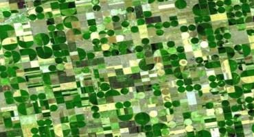
That’s where NASA’s satellite images come in. NASA’s Landsat program takes and archives photos of the Earth’s surface every 16 days. For this grant, Brady and Kirti Rajagopalan from Department of Biological Systems Engineering will use machine learning to look at photos of individual fields from central and eastern Washington and measure their greenness.
On a satellite image, a field that starts the growing season brown and slowly becomes greener, then turns brown again, followed by another cycle of increasing greenness is likely being double cropped. A single cropped field would only show one brown to green cycle, Brady said.
“There’s no way a person, or a dozen people, could look through all those photos of all those fields over 20 years,” Brady said. “But using machine learning, we can see how much double cropping has increased in individual fields over two decades.”
The goal is to use the past 20 years to predict how much double cropping will increase in the next decade or more. The researchers will also look at the same data for parts of California and Arizona, which traditionally have more double cropping due to longer growing seasons.
“As we start to have climates similar to parts of California, we may see food production shift to what was done in those areas,” Brady said.
That could have a big impact on water rights for farmers in the Columbia River Basin. Brady hopes this grant will help decision makers have more data so they can plan for potential water usage increases.
“Double cropping is one potential way to help offset the impacts of climate change on food production,” Brady said. “But we need to plan for water use. This project is a good first step in the process.”
Mingliang Liu and Claudio Stockle from WSU and Perry Beale from the Washington Department of Agriculture are also collaborators on the project. This work is building off of a seed grant from the State of Washington Water Research Center.
Source : wsu.edu