Researchers at Lethbridge Polytechnic developed the web-based program
A new tool is available to help Alberta farmers and trusted ag advisors make better irrigation decisions.
The web-based program is called Irrimap and is the result of work at Lethbridge Polytechnic’s Mueller Irrigation Research Group (MIRG) with support from AAFC and the Saskatchewan Ministry of Agriculture.
The program measures evapotranspiration (ET).
ET is a combination of evaporation, and transpiration, which is the process of water moving through a plant, and the plant releasing the water as vapor through pores in their leaves.
Overall, Irrimap measures how much water moisture is returning to the atmosphere from surface of the Earth.
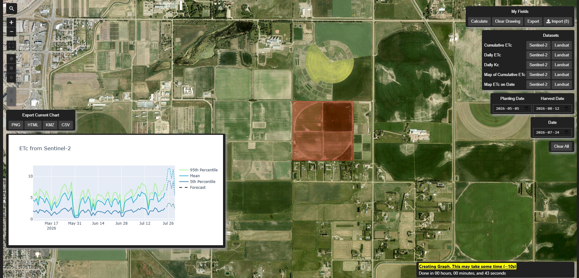
Irrimap (Lethbridge Polytechnic photo).
“It uses Google to download information and provides it at the field scale, which is what farmers need for deciding irrigation management,” said Michael Kehoe, a research scientist with MIRG. “You can remotely locate information that’s relevant to your question immediately and don’t have to go out into the field to measure it yourself.”
Users can select an area and input information like planting and harvest dates and can view Landsat or Sentinel-2 imagery.
The map will then generate a graph of the selected area showing different ET readings of the chosen location.
These readings include the 95th percentile, the mean, the 5th percentile, and the forecast.
“We’re taking a picture of a field and we’re figuring out how much of that field is plant matter and how much the plant is losing in water,” said Derian Setoguchi, a research assistant who coded and programmed the map. “We use open-source weather data to figure out how much the plant should theoretically be putting out and then we multiply that by NDVI value—the biomass—and that gives us how much it should actually be putting out.”
An online instruction manual is available to help users navigate the map and its tools.