After a wet start to the last week of June, we will see some drying for the second half of the week. As a dome of warm air builds aloft, it will produce an above normal temperature week ahead with maximum temperatures mostly in the 80s and minimum temperatures in the 60s and 70s across the state as well.
Look ahead to the week 2 outlook across Ohio, The NOAA Climate Prediction Center is calling for a greater chance of above normal temperatures and rainfall. This will be triggered by storms riding along the northern boundary of a very warm high-pressure system to the south of Ohio. The latest CPC week two outlooks at be found at https://www.cpc.ncep.noaa.gov
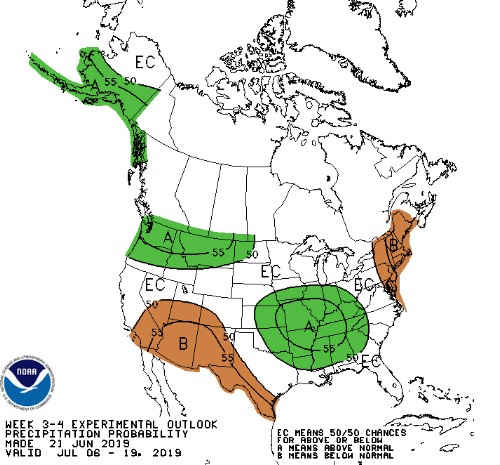
Looking further ahead to week 3 and week 4 outlooks, odds favor a return to slightly below normal temperatures. This will be a function of below normal maximum temperatures. However, minimum temperatures will remain at or above normal due to the high soil moisture conditions and the humid airmass in place. Rainfall is continuing to lean above normal especially in the western half of the heavy agriculture areas of Ohio. See the attached images. The week 3/4 outlooks can also be found at https://www.cpc.ncep.noaa.gov/
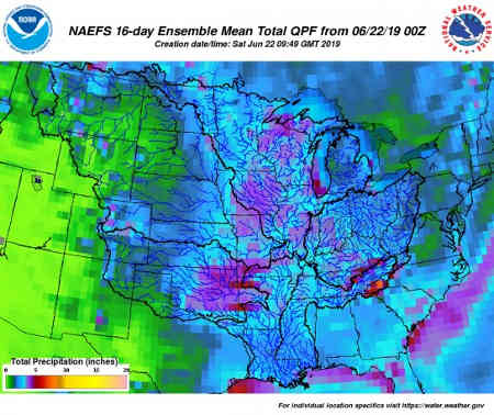
The two-week average rainfall total still looks above normal as discussed above with rainfall averaging 2-4 inches across Ohio. Normal rainfall for Ohio for the two week period is 1.50-2.00 inches.
Source: osu.edu