Cracked dirt, dying crops, boat docks out of water and dry, dusty streambeds. For many communities in the U.S., drought impacts are becoming ever-present and increasingly dire.
It didn’t get that way overnight, though. During long stretches of sunny weather with blue skies overhead, the last thing on your mind is probably drought. Drought often creeps in quietly, without the visual cues that accompany severe storms or other extreme weather, but its impacts can be just as, if not more, devastating than any storm.
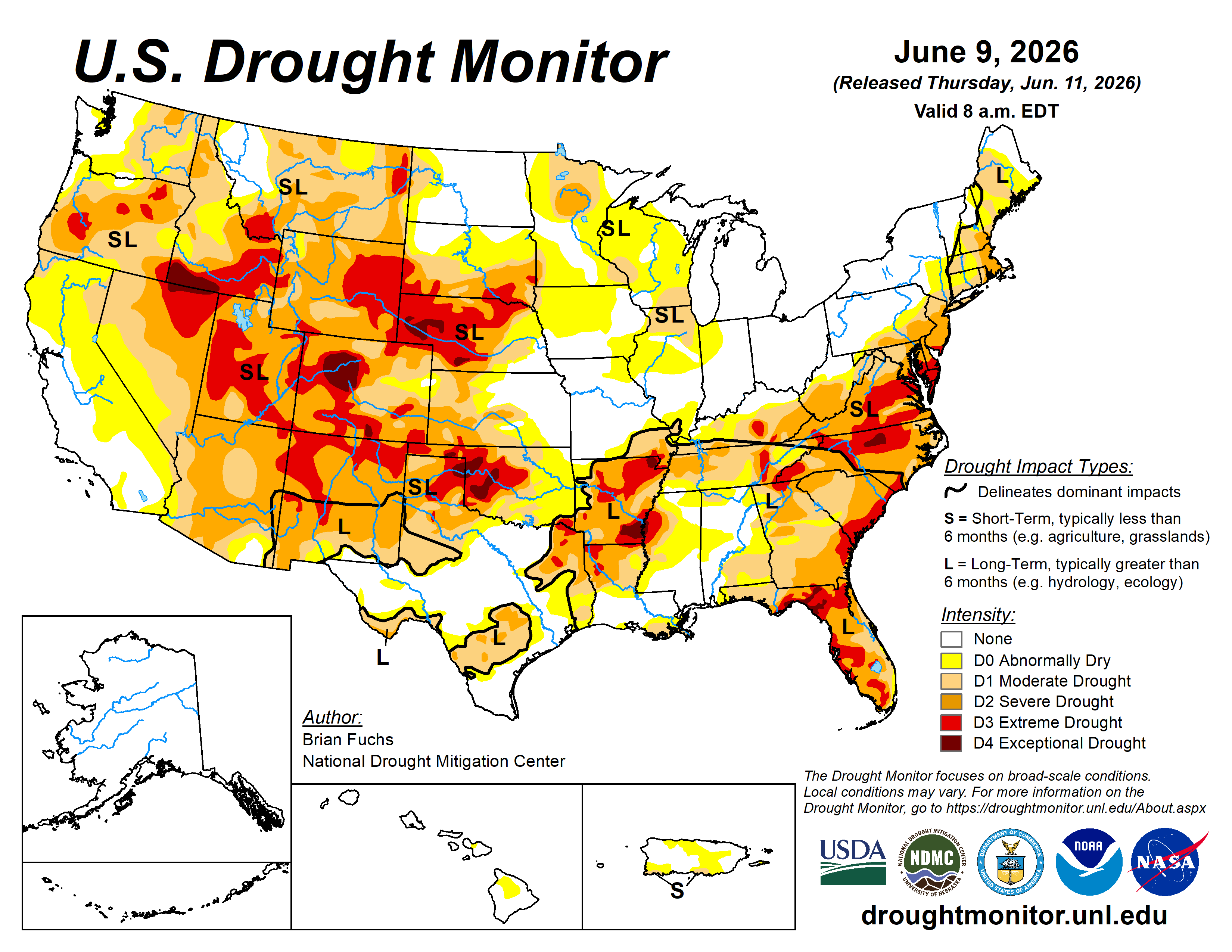
Luckily, NOAA and its partners track drought and dryness with the U.S. Drought Monitor (USDM). The USDM is a vital public resource that is used by policymakers, researchers, and the public to monitor drought conditions. It assists with drought mitigation efforts and determines eligibility for farmers and ranchers who need federal disaster assistance.
The Map…the Drought…the Legend. What is the USDM?
The USDM produces a map every Thursday that shows the location and intensity of drought across the U.S. and its territories. Because drought affects different people in different ways, it is often said that “drought is defined by those it impacts”. For instance, a farmer's experience of drought will look very different from that of a water supply manager or a homeowner watering their home garden. As a result, the USDM captures multiple types of drought on a single map.
Source : noaa.gov