By Pam Knox
Note: While this outlook is primarily for Georgia, it should hold true for most of the southern part of our region as well. The temperature in July was generally slightly cooler than normal, with daytime temperatures below normal (from clouds) and overnight temperatures warmer than normal due to the abundant humidity we have experienced this month. This is also reflected in the wetter than normal rainfall for most of Georgia in July, as several fronts have dropped into the state from the north, serving as a focus of developing thunderstorms that have produced spotty rain across the region. Some areas have seen a lot while other areas nearby have been mostly missed by the showers. Because of the rain, drought conditions in most of the state have seen significant improvements, and these are likely to continue.
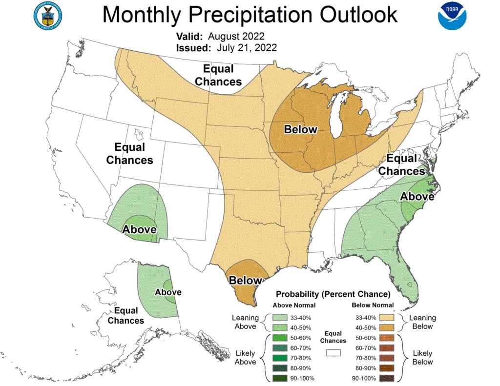
In August, the pattern looks similar to July, especially in the first two weeks. We will continue to see periods of showery weather broken by occasional dry periods. Temperatures are expected to be hotter than normal early in the month but should move back towards more seasonal conditions later in August. Precipitation in the first two weeks is expected to be near normal but is expected to increase again near the end of August, especially if the tropical season starts to ramp up. It will be scattered as we expect in summer thunderstorms, and some areas will see more rainfall than others.
So far this year, the Atlantic tropics have been relatively quiet, with just three named storms and no hurricanes so far. This has been due in large part to large plumes of Saharan dust that affect the vertical temperature structure of the atmosphere and reduce thunderstorm development while cooling the sea surface a little. Once these subside, we should start to see the tropical waves coming off of Africa grow more quickly and turn into tropical storms and hurricanes as the peak part of the tropical season approaches in mid-September. Of course, we don’t know where they will go, but the Southeast usually gets the effects of several of them.
Longer-term, NOAA and others are continuing to predict the continuation of a triple-dip La Nina, which is keeping the Eastern Pacific Ocean one of the few areas in the globe cooler than the long-term average. This is expected to last through winter, which could mean another warmer and drier than normal winter for at least parts of Georgia. Last year when this happened, it meant that some parts of the state did not see frost until well into January, allowing some pests and diseases to overwinter well into the year. This makes early treatment of potential problems, including in-furrow treatment, something of special importance in 2023. However, that is a long way off yet, and ENSO predictions in mid-summer are not always accurate for next winter, so you will need to keep an eye on this when it comes closer to planning for the next growing season.
Source : uga.edu