By Ignacio Ciampitti
Some of the storms and extremely high winds this spring have caused significant stalk breakage in corn fields. In these kinds of storms, it is not unusual to have up to 40% of stalks in some fields broken off at ground level. We see this type of damage somewhere every year. It is usually referred to as “green snap,” “brittle corn,” or “brittle snap.”
Green snap occurs when rapidly elongating corn stalks are subjected to high winds. Corn stalks are elongating rapidly between about V8 to tassel. Typically, corn is most susceptible to green snap in the two- or three-week period from late vegetative until silking. The stalks are growing rapidly and have enough height to catch more wind. These high winds will cause stalks to break in the section close to the lower nodes.
A number of factors can affect the severity of green snap. Anything that contributes to rapid, vigorous growth may make corn more susceptible to this problem. Such contributing factors include high nitrogen fertilizer rates, rotation after soybeans, higher plant densities (promoting early competition and elongation, and thinner stalks) and early planting. Unfortunately, these are also recommended best management practices for corn production.
Timing has a huge impact on the severity of green snap, with much less damage usually evident in younger corn (Figure 1) or in fields that have tasseled and flowered. The factor that can be addressed most readily is hybrid selection. Although no hybrid is immune to the problem, some hybrids are more susceptible to green snap than others.
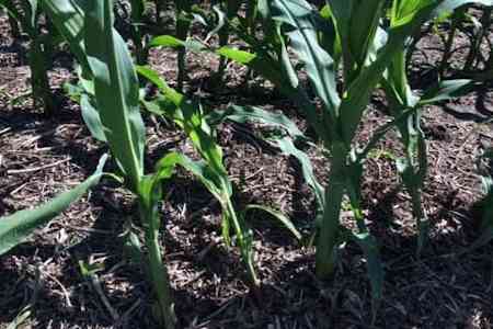
Figure 1. Corn showing effects of wind damage, “green snap,” early during the vegetative period. Photo by Ignacio Ciampitti, K-State Research and Extension.
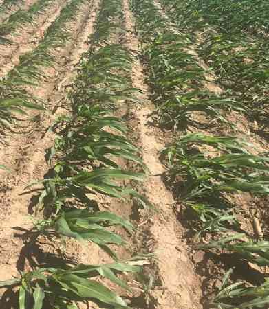
Figure 2. Leaning corn due to the high winds. if this was a later stage, the plant stalks might break in the section close to the lower nodes. Photo by Rachel Veenstra, K-State Research and Extension.
What are the implications of all those broken plants for the current crop? Damaged plants are broken completely in two, so there is no hope for recovery. Even so, the yield loss in an affected field usually will be much less than the stand loss. Before tasseling, surviving corn plants can respond to the additional resources made available by the removal of damaged plants by maintaining larger ears or setting additional ears, or increasing final kernel weight. With 10% or fewer broken stalks, it may be hard to detect a significant yield loss if stands were adequate before the storm.
Yield losses will increase with “patchy” stand losses because surviving plants are too far apart to compensate for lost plants. If large patches are damaged, or if stand losses are significant, there may still be an opportunity to cut the worst areas with a swather or crimper to salvage some forage if it can be utilized. It is not too late to plant sunflower, soybeans, or grain or forage sorghum if the stand is a total loss, depending upon the herbicide program used on the damaged corn crop.
Source : ksu.edu