Geo-referencing soil sample locations allows growers to optimize nutrient usage and input costs
By Ryan Ridley
Farms.com
Soil sampling is a common precision ag practice that allows growers to monitor the progress of their nutrient management plan.
But as we learned at the 2020 Farms.com Precision Agriculture Conference & Ag Technology Showcase, growers can better optimize their nutrient usage and input costs using site-specific soil sampling.
Brandon Yott, Business Development Manager – Precision Ag Technologies at A&L Canada Laboratories, explained the importance of geo-referencing soil sample locations conference attendees.
“We really need to geo-reference where we are taking our soil samples from,” he explains. “One of the reasons I strongly believe that is if we’re going to track our nutrient changes over time, or try and look at ROI on changing a nutrient use pattern or application method, we need to be able to go back to the same exact spot from where we sampled from in the past and collect samples from there over time to monitor those changes.”
Yott gave an overview of A&L Canada Laboratories’ TerraSiteRx, a new data analysis platform that integrates farm data sets with site-specific soil maps.
“We’ve seen huge differences in soil variability just feet away from [sample] points. I would say the more accurate you can get on geo-referencing your samples the better – even if you’re taking bulk or composite – I still recommend geo-referencing soil samples to keep that consistency. That’s very important moving forward,” adds Yott.
The TerraSiteRx platform generates 30 information maps, showing the various levels of nutrients spatially mapped across the field.
Soil maps include, but are not limited to the following:
- Potassium
- Magnesium
- K/Mg
- Calcium
- Zinc
- Iron
- Copper
- Boron
- Sulfur
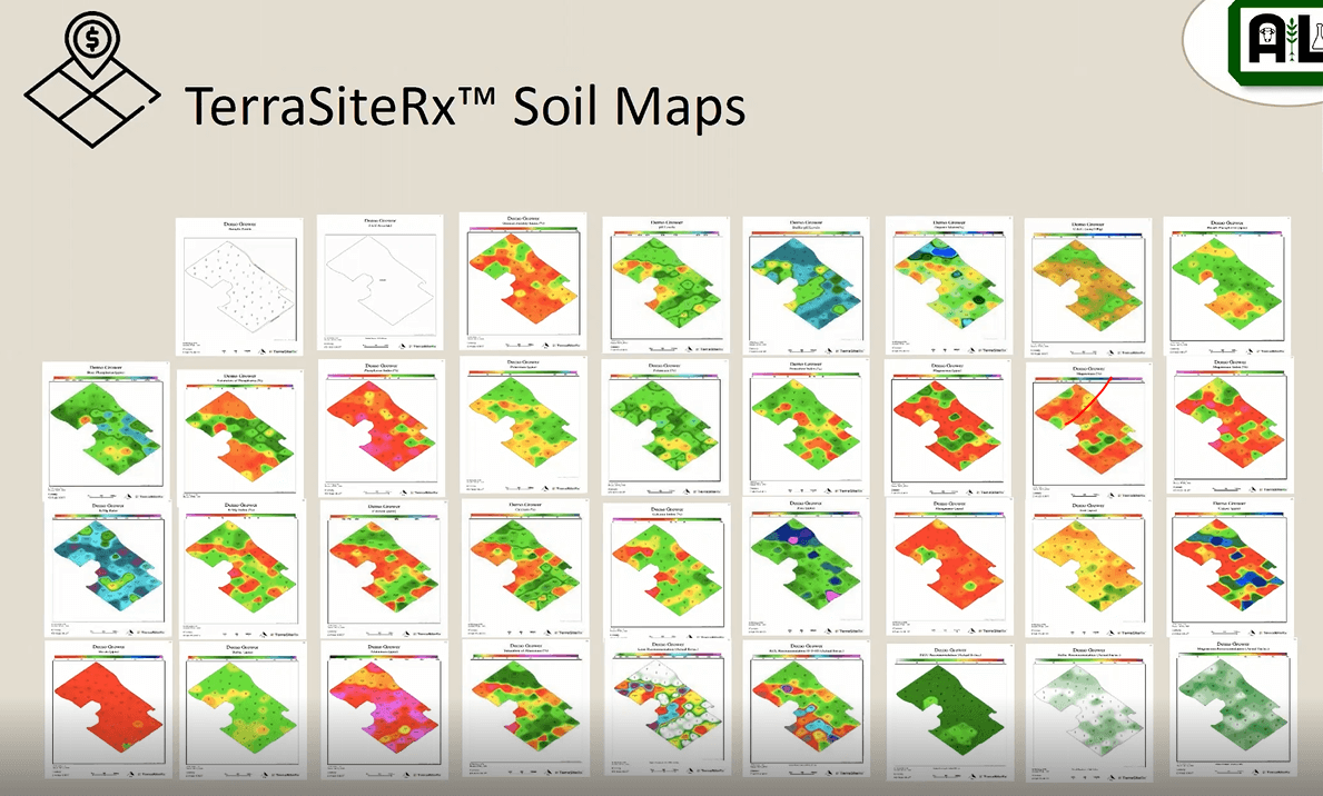
These spatial nutrient variability maps are created with geo-reference information from the soil samples to discover the optimum levels of nutrients within a field based on measured biomass nutrient interactions.
“Right now, a lot of our algorithms have been tying those nutrient interactions to variable rate nutrient recommendations or yield opportunity, but right now we are working on how that correlates to disease,” says Yott.
The soil maps are the baseline for site-specific soil analysis, which allows growers to track nutrient changes over time.
“We strongly recommend site-specific as a foundation for your farms. It’s really the best way to optimize our nutrient use to try to get better cost efficiency for things like VR application on the farm,” explains Yott.
Separate from soil maps, TerraSiteRx also has tools for measuring crop damage, modified NDVI, plant count, zone sampling and crop stress maps.
To learn more about TerraSiteRx’s soil analysis process and applications, watch the video:
Photo: terrasiterx.com